

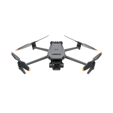
When someone goes missing in dense bush, mountainous terrain, or after dark, every minute matters. Search and rescue teams and emergency services across South Africa are increasingly turning to thermal drone technology to cover ground faster and locate missing persons in conditions where traditional search methods struggle. If you want to discover the DJI Mavic 3TA capabilities, this article walks through how dual thermal and visual camera systems are changing the pace and reach of emergency response.
By the end of this article, you will understand how thermal imaging detects what the human eye cannot, why extended transmission range matters for large-scale searches, and how these tools help coordinators make faster, better-informed decisions in the field.
Seeing What the Naked Eye Cannot
Locating a missing person in thick vegetation, at night, or across sprawling rural terrain is one of the toughest challenges search and rescue teams face. Ground teams can only cover so much area, and visual searches lose most of their effectiveness once the light fades.
Thermal imaging solves this by detecting heat signatures rather than relying on visible light. A person hidden beneath foliage or partially obscured by shadow still radiates body heat, and that heat signature shows up clearly on a thermal sensor regardless of how dark or overgrown the surroundings are. This gives search teams a way to scan large areas methodically, rather than relying on ground crews working section by section on foot.
Covering Extensive Search Areas Without Losing Contact
A search operation is only as effective as the ground a team can realistically cover, and the distance the aircraft can maintain a reliable connection over. With a transmission range of up to 15 km, the operator keeps a strong, stable video feed even as the drone moves well beyond the launch point, which is essential when searching along riverbanks, ridgelines, or expansive farmland where the point last seen could be kilometres from the command post.
This extended range, paired with a flight time of up to 45 minutes, means a single mission can methodically sweep a much wider search grid without constant battery changes interrupting the effort. For coordinators managing a search across difficult or unfamiliar terrain, that translates directly into more ground covered before conditions change or daylight runs out.
The Value of Combining Thermal and Visual Data
Thermal detection tells a team that something warm is present. Visual confirmation tells them what it is. Running both camera systems together means a heat signature spotted from altitude can be visually verified almost immediately, cutting down on false leads and helping teams commit resources to genuine finds rather than chasing every heat spike on the thermal feed.
This combination is particularly valuable in mixed environments, such as farmland bordering dense bush, where livestock, wildlife, and vehicles can all generate heat signatures alongside a missing person. Being able to switch between or overlay thermal and visual imagery gives search coordinators the context they need to make faster, more confident calls.
Operating Effectively Regardless of Time or Terrain
Search and rescue operations rarely happen in ideal conditions. Missing person cases often begin or extend into the evening, and terrain in South Africa ranges from dense coastal bush to open highveld and rocky mountain passes. Equipment that only performs well in daylight or open ground limits how quickly a search can progress once conditions change.
Thermal-equipped drones extend the operational window well beyond what visual-only search methods allow, meaning teams are not forced to pause a search overnight or wait for better visibility. For emergency services balancing urgency against limited daylight hours, this shift in capability changes how quickly a response can move from search to recovery.
Supporting Faster Coordination on the Ground
Beyond detection itself, real-time aerial data helps search coordinators direct ground teams more precisely. Rather than deploying personnel to search an entire grid reference, a drone operator can guide teams directly toward a confirmed heat signature, reducing the physical strain on ground crews and shortening the time between detection and reaching the person in need.
For agencies managing security operations alongside search and rescue readiness, this capability also complements broader aerial monitoring strategies already in use across security drone deployments in agricultural and rural settings.
Choosing the Right Configuration for Your Team
Every search and rescue unit operates differently, depending on terrain, team size, and the areas they are typically called to cover. As a distributor of DJI’s enterprise range, we work with emergency services and search and rescue teams to help identify the aircraft and sensor configuration best suited to their operational area, rather than a one-size-fits-all approach.
Frequently Asked Questions
Can thermal drones detect a person under dense vegetation? Thermal sensors detect heat signatures rather than relying on a clear line of sight, which means partial cover from foliage or shadow does not prevent detection in most cases.
Do thermal drones work during the day as well as at night? Yes. Thermal imaging is effective in both daylight and darkness, though it is particularly valuable once visual searches become unreliable after dark.
How does thermal detection reduce false alerts during a search? Pairing thermal detection with a visual camera allows operators to confirm a heat signature visually before committing ground resources, reducing wasted time on false positives.
Ready to Strengthen Your Search and Rescue Capability?
Thermal drone technology is reshaping how quickly and effectively search and rescue teams can respond when it matters most. Whether you are equipping a dedicated search and rescue unit or expanding an existing emergency response toolkit, we can help you find the right configuration for your team’s operational needs.
Get in touch with Afri Air to discuss thermal drone solutions suited to your search and rescue operations.


